The Bee Guy & More
The Journey and Mission of Gary W. Breisch
“My mission is to help others bee healthy, happy and have more energy than ever!” —Gary W. Breisch
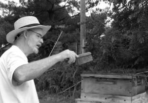
Gary was known by many as the “Bee Guy” later in his life. He held many titles and served his the Sand Springs and Tulsa community in many other ways. More broadly, he reached countless people through social media, helping bring awareness to honey bees and organic gardening, having over 4.5K followers and having to open additional Facebook accounts to allow for more friends to follow. It’s said that he has over 1,000 facebook groups… maybe more, let’s just say it was more than you can imagine. 😉
Gary was born in Tulsa, Oklahoma and while in grade school, his family moved to Sand Springs, OK. He graduated from Charles Page High School in 1968 and went on to Oklahoma State University where he graduated with a Bachelors of Science in Civil Engineering and became a licensed Land Surveyor.
Most importantly, he brought love, zeal for life and a unique creative mind to our planet for 72 years before transitioning to the next “great adventure” as he described it. 🐝